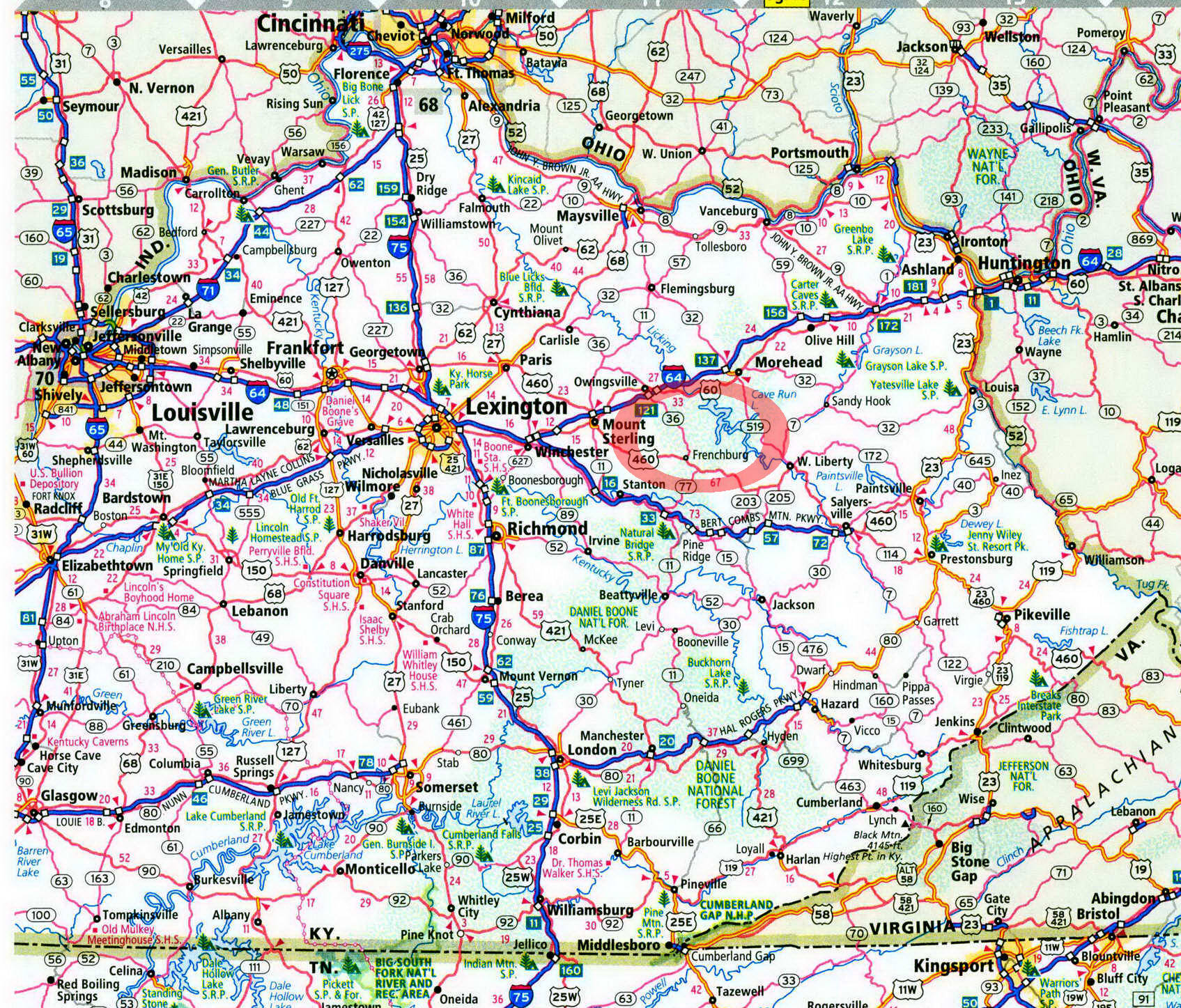
Clear Creek Campground in Kentucky on map

Clear Creek Campground
Clear Creek lies next to the best mountain biking and hiking in the northern part of the Daniel Boone National Forest
When coming to Clear Creek Campground, I first saw Clear Creek Lake, an appealing, translucent impoundment backed by green wooded ridges. After that, things only got better. A front had moved through, clearing the haze from the summer sky. Sunbeams shot from above and filtered through the trees. The temperature was just perfect. I rolled into the campground, picked a site, and then ran over and looked at Clear Creek. It lived up to its name. Then came the dilemma—what to do first on such a day? Should 1 walk some of the 30 miles of trails of the nearby Pioneer Weapons Wildlife Management Area, fish Clear Creek Lake, check out the old iron furnace, drive the Zilpo Scenic Byway, or see the arch south of here on the Sheltowee Trace?
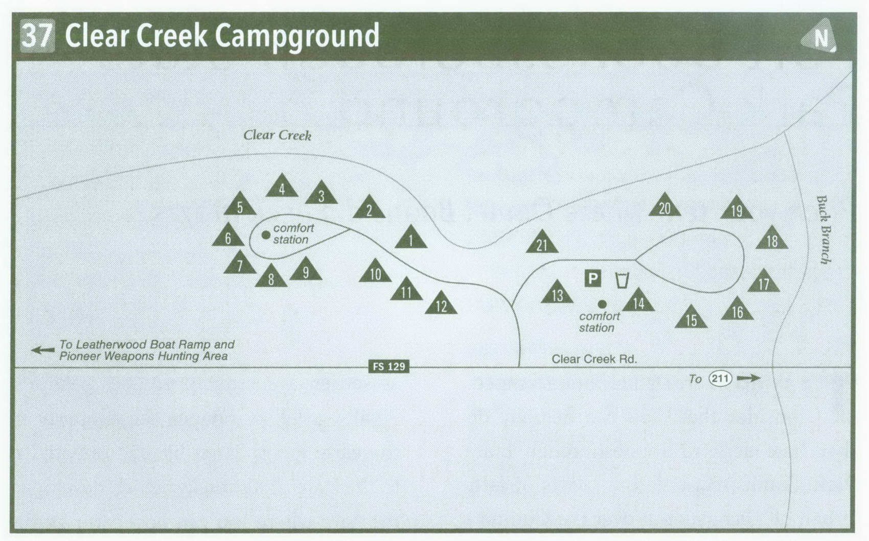
I set up camp first. The campground is laid out in a flat along Clear Creek. Enter the campground, and take a left up the flat to sites 1-12. A lush forest of oaks, dogwoods, and tulip trees shades the camps, which are well separated by these trees and thick undergrowth; it's hard to see from one site to the next. Several streamside sites are snapped up first. Circle to a miniloop with sites spoking from it. and a modern vault toilet and water pump in the middle. Campsites 13-21 lie down the flat. A campground host occupies the first site and keeps the facility in good shape. Here, you'll find plenty of large, well-separated sites, with a few hemlocks adding to the shade. A miniloop with more choice sites lies at the end of this road as well.
A positive and negative of the campground is the nearby Zilpo Scenic Byway: it's great for auto touring and exploring other areas of the forest, but it is audible from the campground. However, this is not a heavily used commercial road—far from it. Clear Creek fills on many pretty weekends, mainly because of overflow from the much larger and busier Zilpo Campground (see page 163), which is down the scenic byway.
After setting up camp, I cruised over to the Pioneer Weapons Wildlife Management Area, adjacent to the campground. Several mountain bikers were camped at Clear Creek. Unfortunately, I left my bike at home. I settled for exploring Buck Creek Trail by foot after taking the Shel-towee Trace north a bit. This creek was clear as well. A doe and fawn were feeding on the edge of the stream. Later, I cruised down to check out the Clear Creek iron furnace, where in the mid-i8oos ore was melted into "pigs" for shipment down the Ohio River. These pigs were used to make wheels for the locomotives of the day. I continued down the Clear Creek Lake Trail to Clear Creek Lake. Unfortunately, I left my canoe at home. This body of water is a "no gas motors" lake, making for a quiet canoeing (and fishing) experience. The next day I decided to walk south down the Sheltowee Trace. After a couple of miles, I reached Furnace Arch, on the right of the trail. The arch itself held appeal, but a view from the top of it added to the hike. It has possibly the best vista on the entire 280-mile Sheltowee Trace Trail. Unfortunately, I left my camera at home and smart phone at camp. Later, I took a scenic drive. Fortunately, I had my car with me. I motored the Zilpo Scenic Byway and stopped at Tater Knob Fire Tower. Built in 1934, the structure was restored in 1993 and is now on the National Historic Lookout Tower Register. Views are great here too. Cave Run Lake and the hills and valleys of the forest stretched out on the horizon. I reflected that on my next Clear Creek adventure I'd bring my bike, canoe, fishing rod, and camera.
Key Information about Clear Creek Campground
ADDRESS: 2375 KY 801 South, Morehead, KY 40351
OPERATED BY: U.S. Forest Service
CONTACT: 606-784-6428, www. fs. usda. gov/ dbnf
OPEN: Year-round
SITES: 21
SITE AMENITIES: Picnic table, fire ring, lantern post, tent pad
ASSIGNMENT: First come, first served; no reservations
REGISTRATION: Self-registration on-site
FACILITIES: Water spigots, vault toilets
PARKING: At campsites only
FEE: $10 November-mid-April, $12 mid-April-October
ELEVATION: 770 feet
RESTRICTIONS in Clear Creek Campground
¦ Pets: On 6-foot leash only
¦ Fires: In fire rings only
¦ Alcohol: At campsites only
¦ Vehicles: No more than 2 per site
¦ Other: 14-day stay limit
Getting to Clear Creek Campground
From Exit 123 on I-64 near Owingsville, take US 60 East 6.5 miles to Salt Lick. Turn right onto KY 211. (Ignore the left turn on KY 211 that precedes the right turn.) Follow KY 211 3 miles to KY 129. Take a left on KY 129, Clear Creek Road, and follow it 3 miles to the campground, on your right.
GPS COORDINATES N38° 2.760 W83° 35.172'
