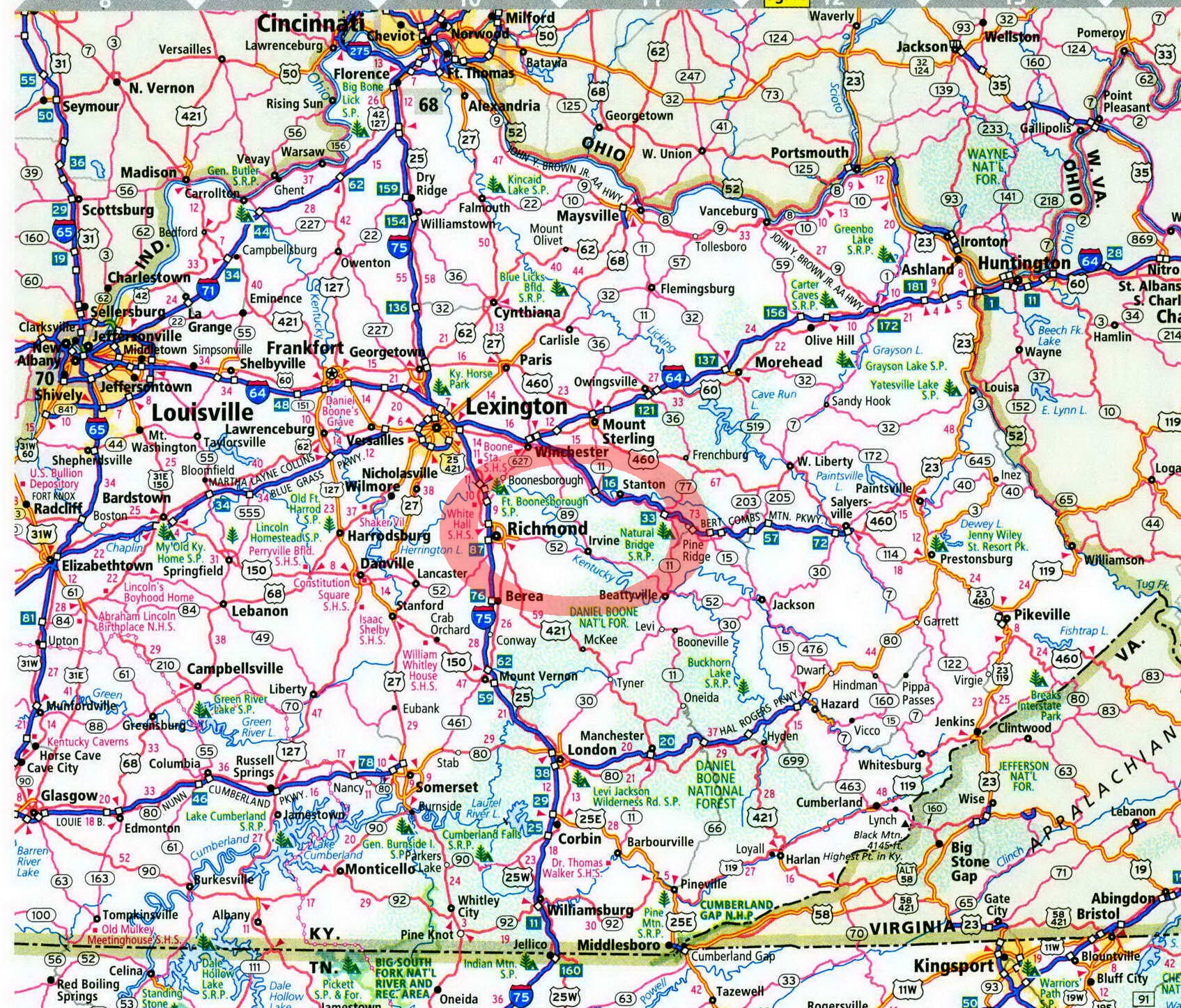
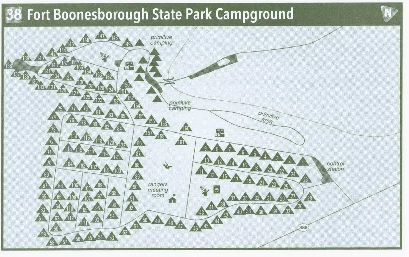
Fort Boonesborough State Park Campground in Kentucky on map

Fort Boonesborough State Park Campground
Pitch your tent where Daniel Boone did back in 1775.
To camp where Daniel Boone camped. Consider that. You can actually do that here at Fort Boonesborough State Park, thanks to numerous twists of fate. When ol' Dan'l set out over the Cumberland Gap from Tennessee to build a settlement, he chose the banks of the Kentucky River, right here, to build his town. Specifically, he spied out Sycamore Flats, the primitive camping area at what is now the state park, for his fort out of which a town would grow. Before he could get started, though, one of his comrades persuaded Boone to locate the fort on higher ground adjacent to Sycamore Flats. Fort Boonesborough was eventually abandoned, as settlers went on to greener pastures. Finally, a fellow bought the property in the early 1900s. Then his son donated it to the state of Kentucky, which developed the park where you can now camp at the location where Daniel and company laid their heads.
The main campground is above Sycamore Flats. Several rows of RV spaces lie in an open, sun-whipped plain. The 167 sites remind me of an RV dealership where I wouldn't want my worst enemy to camp. I wonder . . . what would Daniel Boone think of this? The redeeming values of this area are the bathhouses and the ranger's meeting room, where there are indoor games for rainy days. Drive past the main campground and veer right, dropping down into Sycamore Flats. True to its name, huge sycamore trees, along with maples, shade the camping area. Grass grows in places where the sun reaches the ground. Two small creeks bisect the flat. The sites are laid out in a somewhat hodgepodge fashion. (I hope Daniel's outfit was more organized than the primitive camping area.) To the right are some popular sites before the campground road splits. The road to the right runs alongside a small creek, comes to some sites open to sun and shade, and ends in a small loop near the campground check-in station. The other road crosses a bridge and reaches more scattered sites.
One thing Daniel's cohort was right about was the penchant for Sycamore Flats to flood. The threat back in 1775 was from the Kentucky River exceeding its banks. Today, a dam lies just upstream of the campground, eliminating that worry. Still, the flats can get muddy after rains, making some of the campsites less than desirable. But the knowledge of camping where Daniel Boone camped overshadows that. The primitive area rarely fills, save for summer holiday weekends. A camp store is located near the entrance for convenience.
The fort that began in Sycamore Flats, then was moved a short distance, is no longer there. However, you can tour a replica that follows the actual design of the original, built within walking distance of the campground. Militia reen-actments, rustic-living skills, and old-time ways are demonstrated year-round, giving you an idea what times were like then. Add to that the idea of hostile American Indians outside the fort walls who didn't want you around.
The best way to access the fort is the Pioneer Forage Trail. Back in 1775, camp stores and chain stores weren't around, and the settlers had to get what they could from the land. Along the way, plants and trees used by the settlers for food and shelter are marked. This 0.75-mile-long trail starts near the campground entrance. Another interesting path is the Kentucky Riverwalk Trail; it keeps in the valley of the river, passing by natural, human, and geologic features. Also along the banks of the Kentucky River, upstream of the campground near the dam, is a swim beach. Anglers can bank-fish the river or use the park boat ramp to launch their craft.
If you like chlorinated water, swim in the large, modern pool, which is open from Memorial Day to Labor Day. Park programs are held every weekend to keep child and adult campers busy learning more about the human and natural history of Kentucky. These programs will remind you, while lying on the ground of Sycamore Flats, that Daniel Boone paved the way for all of us to enjoy the beauty of this area.
Getting to Fort Boonesborough State Park Campground
From Exit 94 on 1-64 near Winchester, head south on KY 627 South Truck/KY 1958 3 miles to KY 627. Turn right on KY 627 South, and follow it 7 miles to KY 388 South. Turn left on KY 388, and follow it a short distance to the campground, which will be on your left.
GPS COORDINATES N37° 53.782' W84° 15.959'
Key Information about Fort Boonesborough State Park Campground
ADDRESS: 4375 Boonesborough Rd., Richmond, KY 40475
OPERATED BY: Kentucky State Parks
CONTACT: 859-527-3131, parks .ky . gov; reservations: 877-444-6777, reserveamerica . com
OPEN: Year-round
SITES: 30 primitive, 167 water and electric
SITE AMENITIES: Picnic table, fire ring
ASSIGNMENT: First come, first served and by reservation
REGISTRATION: At campground entrance booth
FACILITIES: Hot showers, flush toilets, laundry, pay phone, camp store
PARKING: At campsites only
FEE: $14-18 primitive; $28-$37 others
ELEVATION: 600 feet
RESTRICTIONS in Fort Boonesborough State Park Campground
¦ Pets: On 6-foot leash only
¦ Fires: In fire rings only
¦ Alcohol: Prohibited
¦ Vehicles: None
¦ Other: 14-day stay limit
