Map of interstate 10 highway in California, Arizona, New Mexico, Texas, Louisiana, Mississippi, Alabama, Florida
Map of Interstate highway 10 Los Angelos-Phoenix-El Paso-San Antonio-Houston-Lafayette-Mobile-Tallahassee-Jacksonville
Interstate highway I-10 Connects the cities of California, Arizona, New Mexico, Texas, Louisiana, Mississippi, Alabama, Florida state. Detailed map of interstate route I-10 with interchange and exit numbers.
Interstate 10 passes near several major cities Los Angelos, Riverside, Phoenix, El Paso, San Antonio, Houston, Lafayette, Mobile, Tallahassee, Jacksonville.
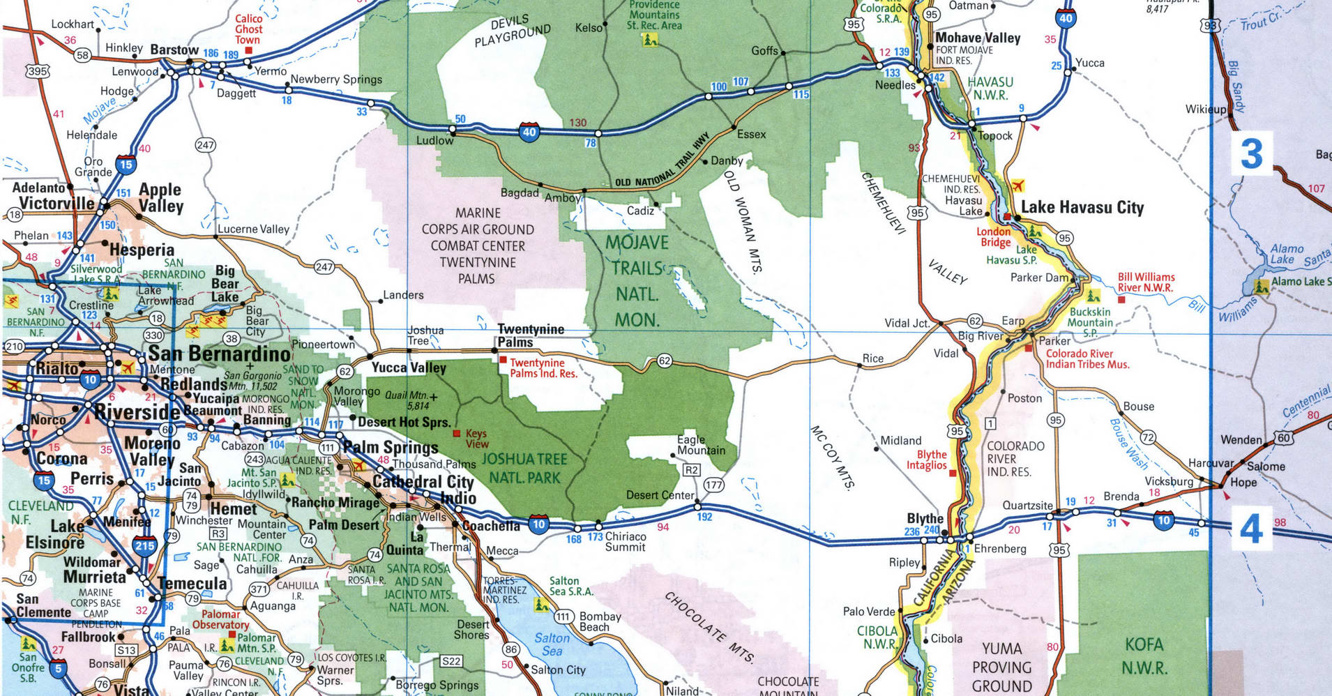
Map of Interstate 10 in the Phoenix area
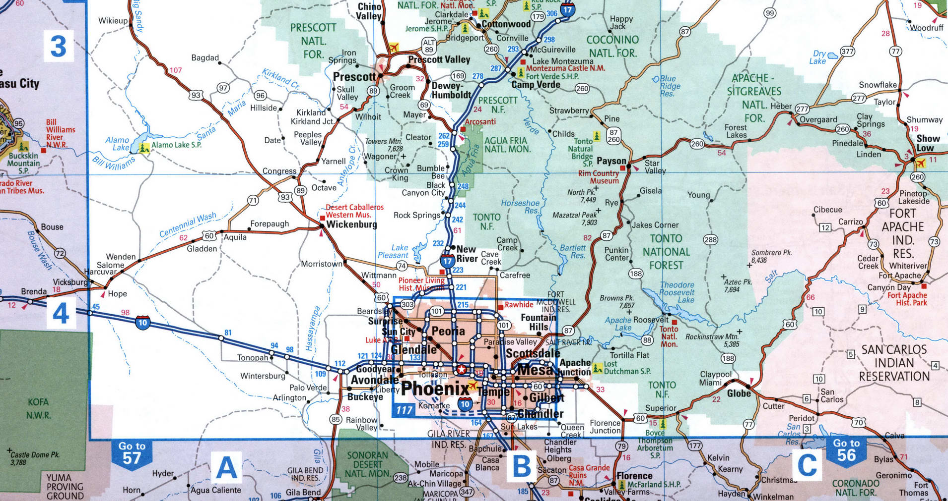
Map of Interstate 10 in the El Paso area
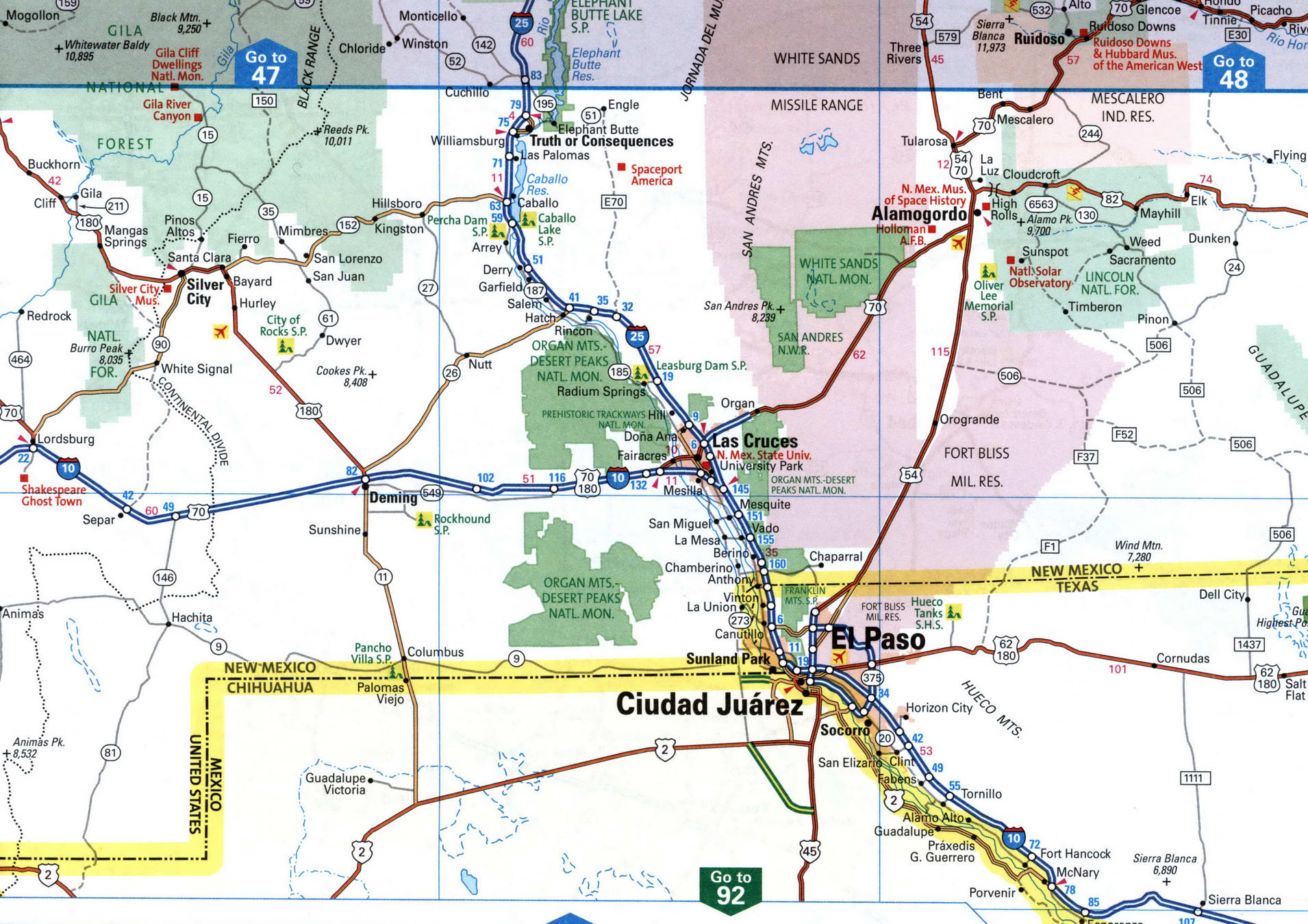
Map of Interstate 10 in the Fort Stokton area
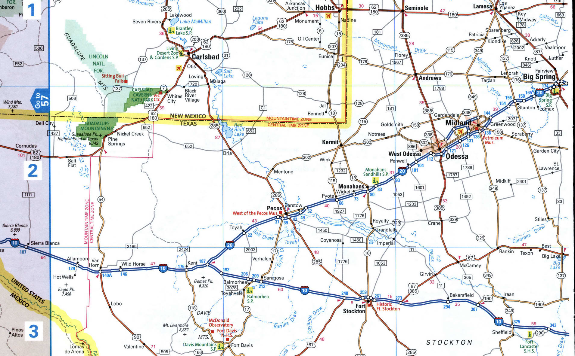
Map of Interstate 10 in the San Antonio area
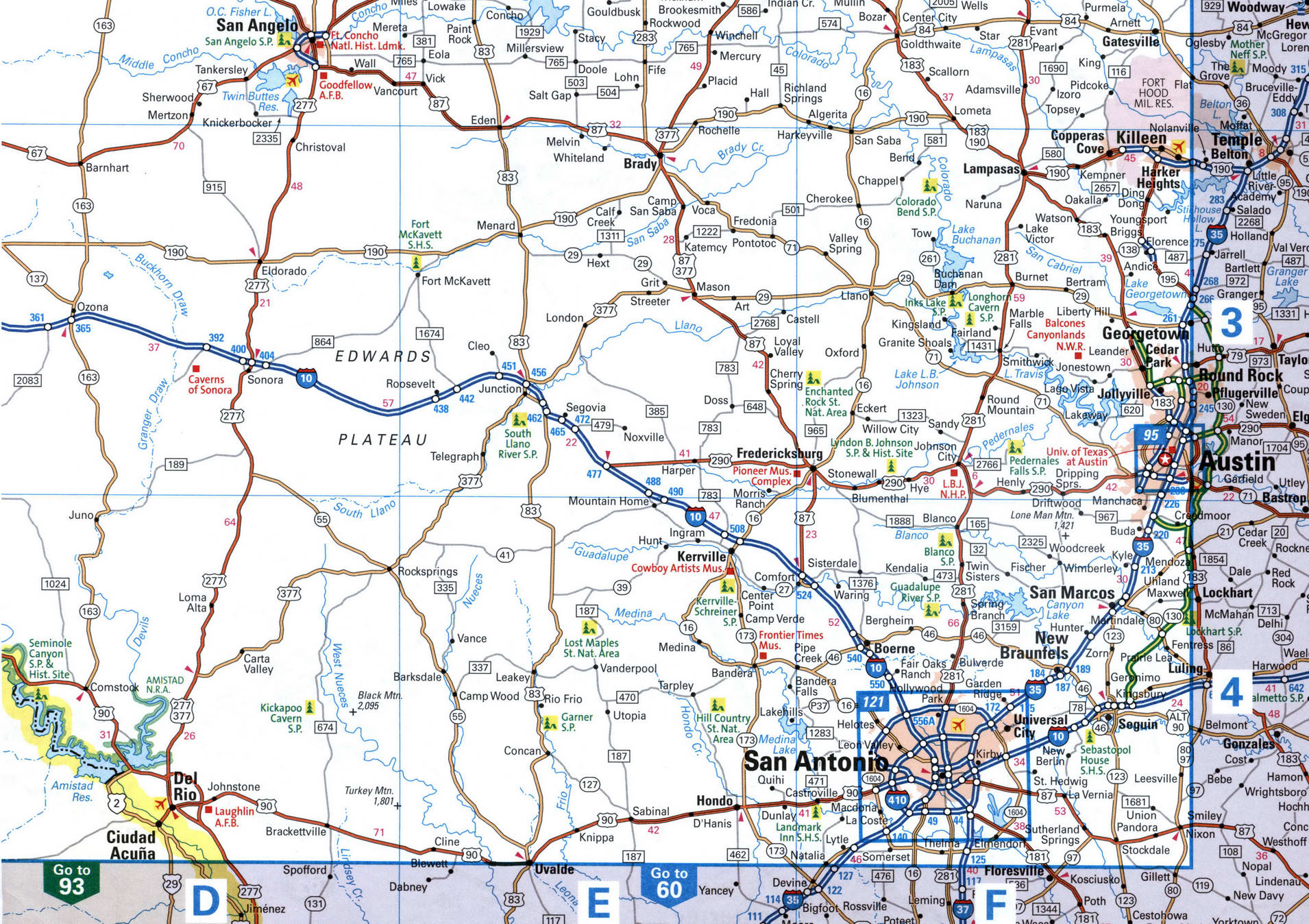

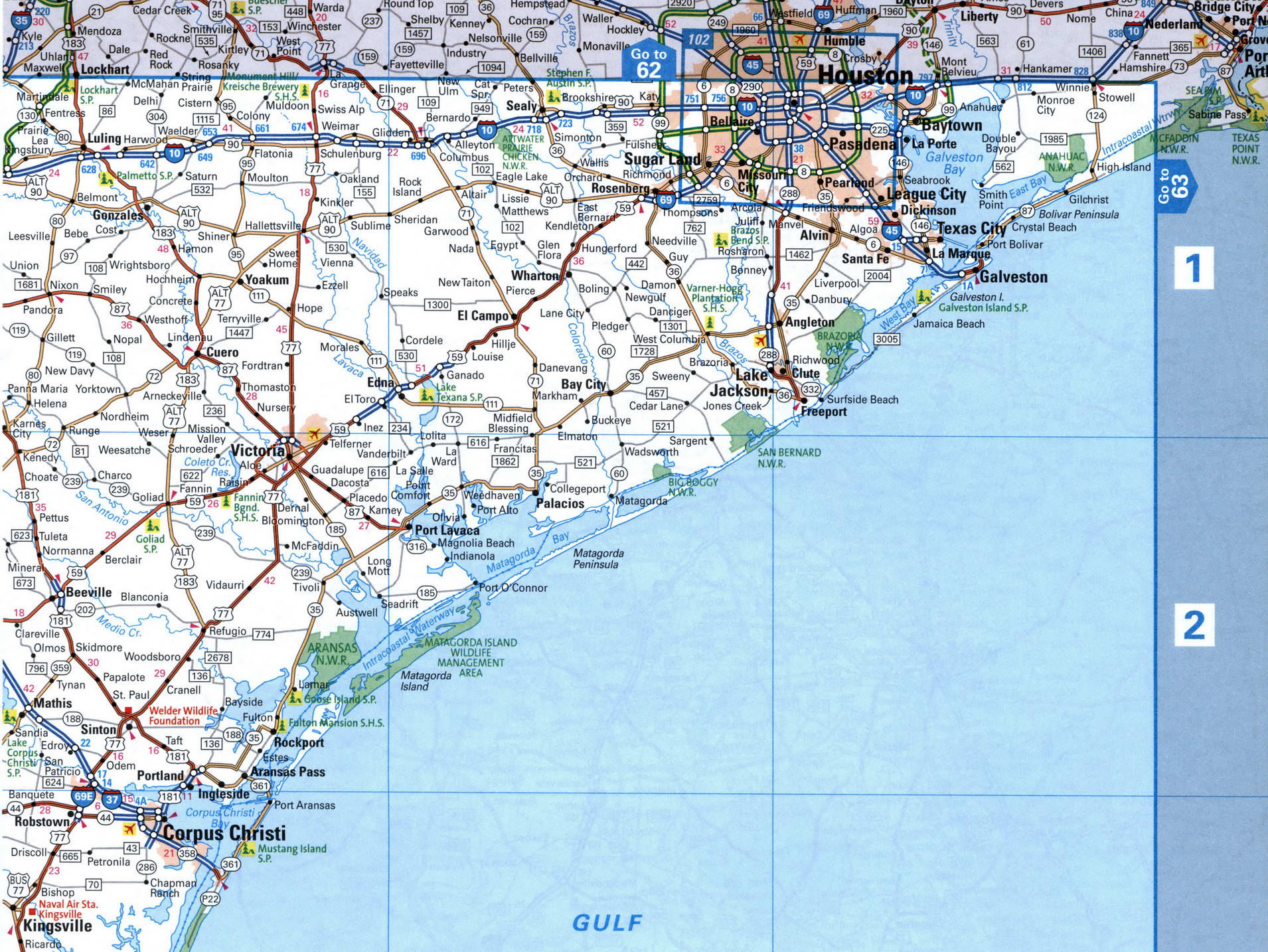
Map of Interstate 10 in the Houston area

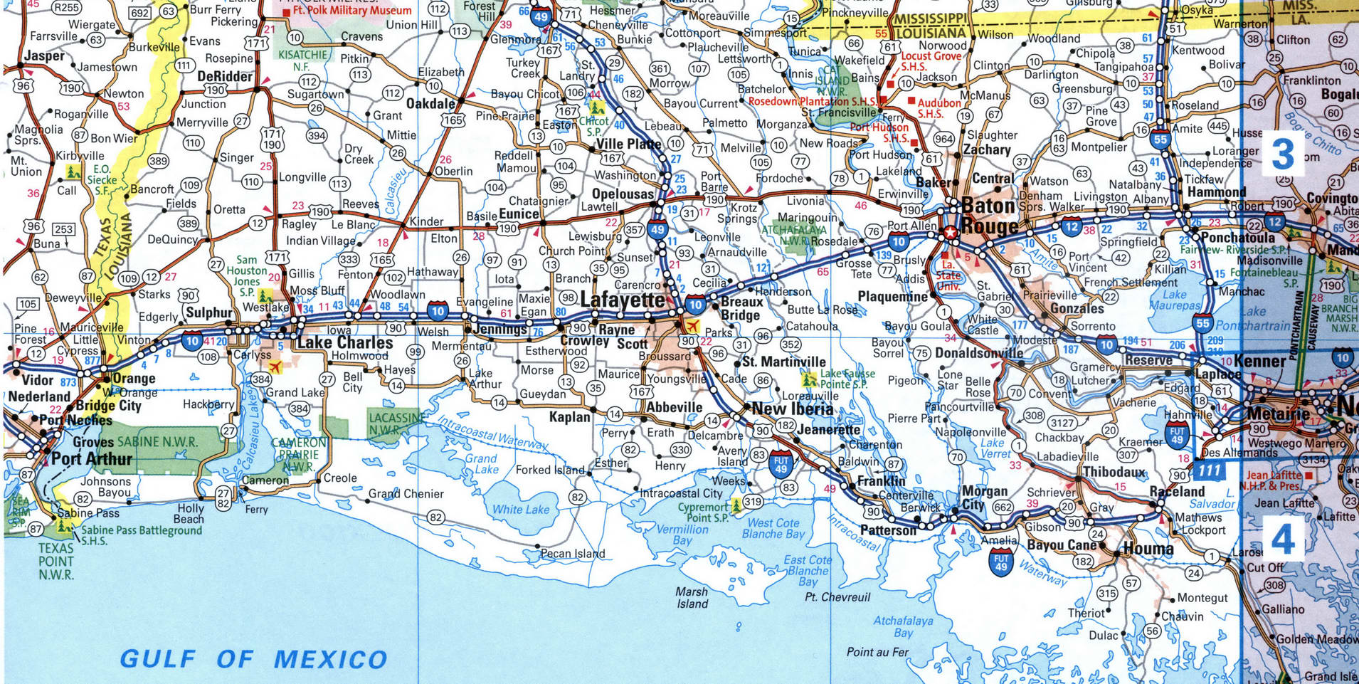
Map of Interstate 10 in the Baton Rouge area
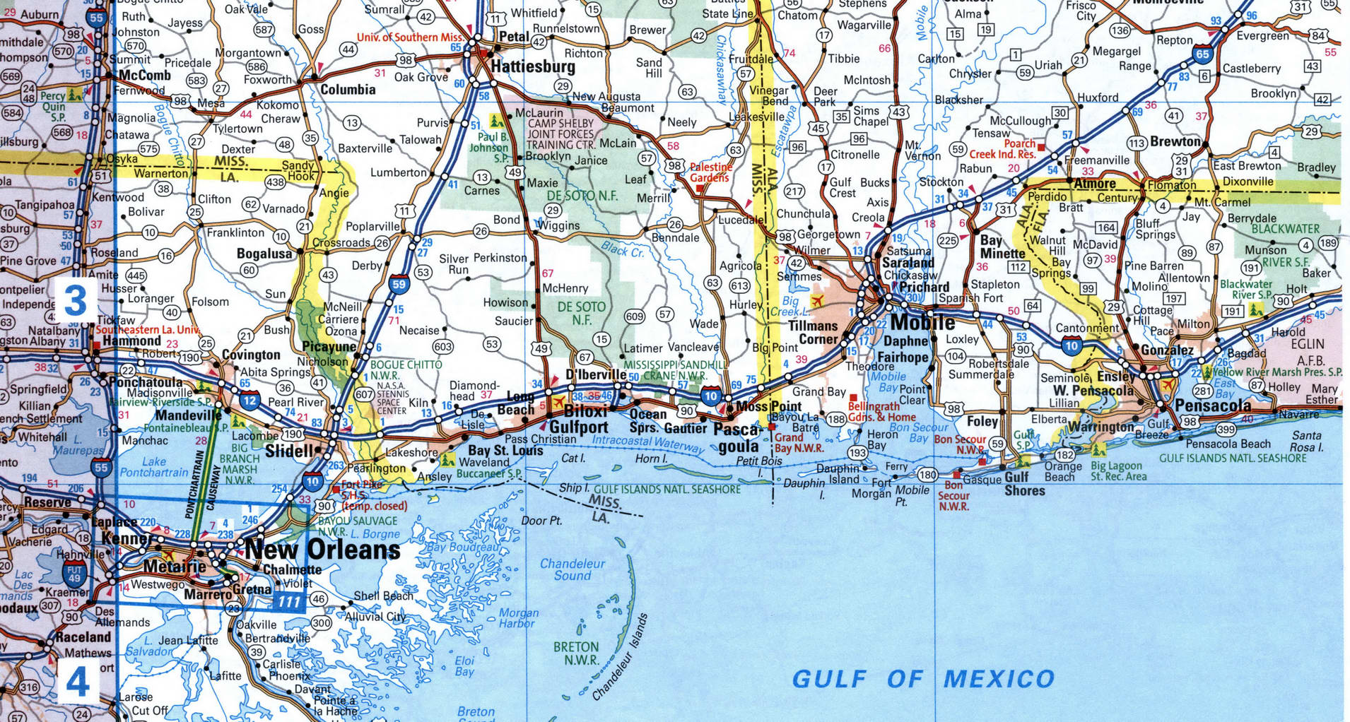
Map of Interstate 10 in the Mobile area
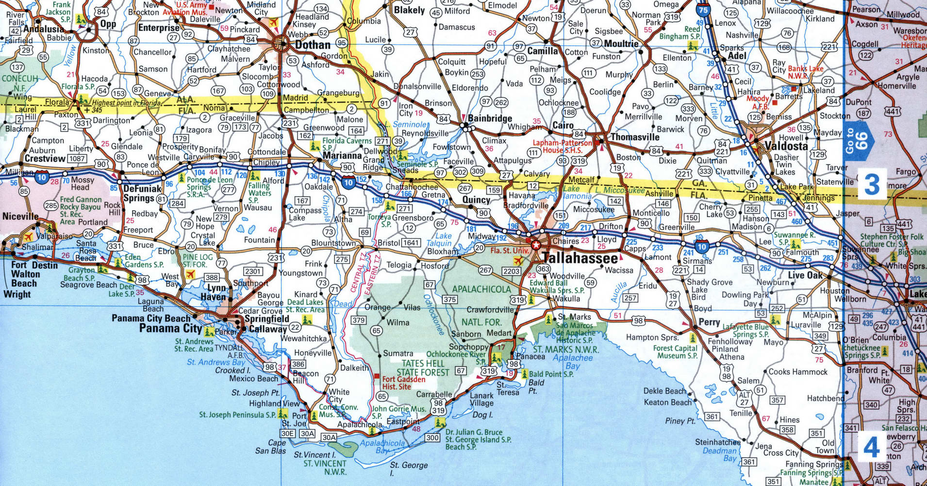
Map of Interstate 10 in the Tallahassee area
Map of Interstate 10 in the Jacksonville area
