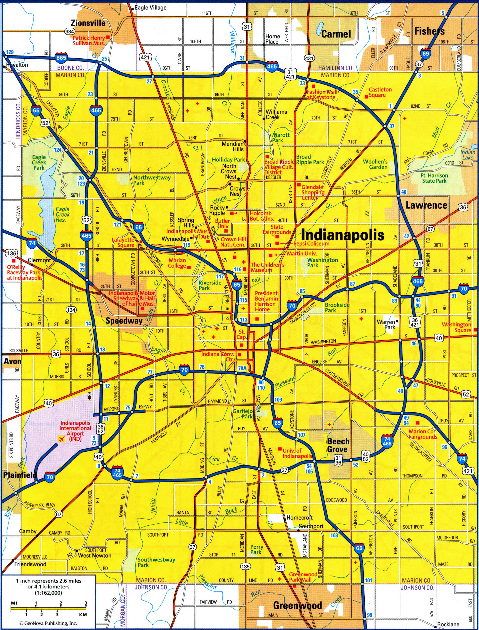
Indianapolis IN city map. Detailed updated map of all roads in Indianapolis and the suburbs
Map of Indianapolis city. Detailed updated map of all roads in Indianapolis
Highways and roads map of Indianapolis city IN. Detailed large scale road map of Indianapolis city USA with interesting places. Easy read map of the highway and local roads of Indianapolis city with the numbers of roads and with interesting places, national parks, state parks, recreation area, museums, universities, colleges.
Indianapolis IN city map. Indianapolis city map with street names. Free printable detailed map of Indianapolis city Indiana

Map of Indianapolis city
Highways and roads map of Indianapolis city IN. Detailed large scale road map of Indianapolis city USA with interesting places. Easy read map of the highway and local roads of Indianapolis city with the numbers of roads and with interesting places, national parks, state parks, recreation area, museums, universities, colleges.
