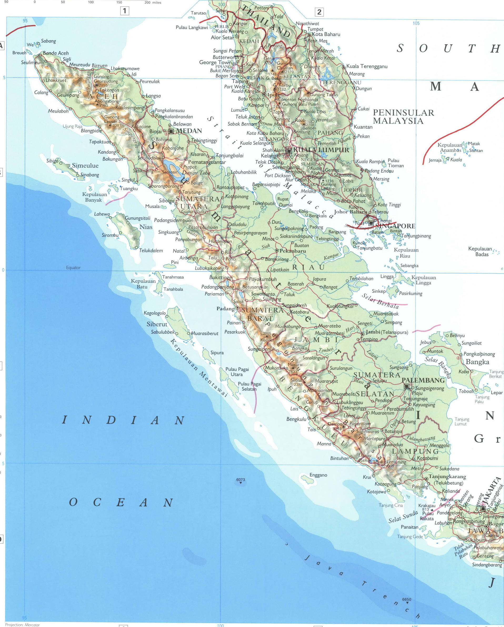
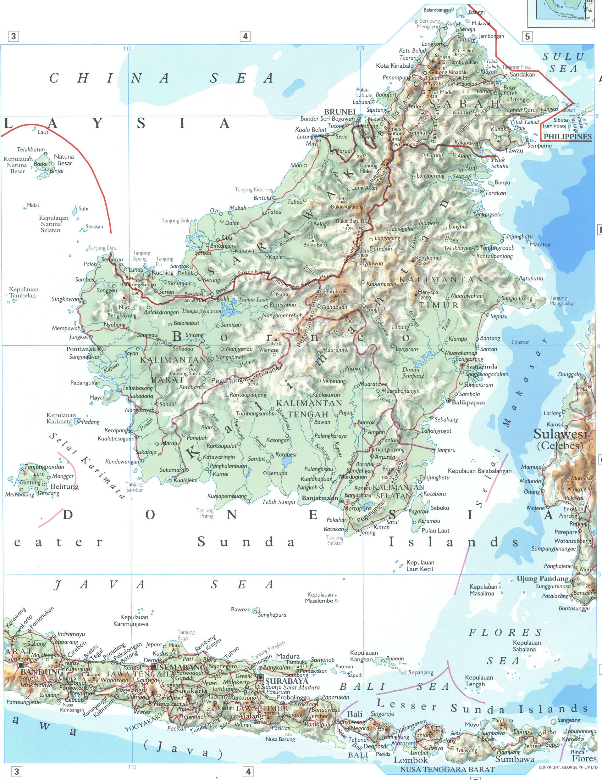
Map of Western Indonesia. Map of Sumatra Island. Map of Borneo Island
Map of Western Indonesia with cities. Map of Sumatra Island. Map of Borneo Island
Physical map of Western Indonesia with cities and towns. Free printable map of Western Indonesia. Large detailed map of Western Indonesia in format jpg. Geography map of Western Indonesia with rivers and mountains.
The map shows the major cities of Kualulumpur, Singapore, Medan, Palembang, Jakarta, Semarang, as well as nearby small towns and villages, connecting their highways and local roads.
The map shows the Strait of Malacca, Sumatra Island, Borneo Island, Java Island, Java Sea, Bali Sea, China Sea, Malaysia Peninsula.


Map Western Indonesia
Physical map of Western Indonesia with cities and towns. Free printable map of Western Indonesia. Large detailed map of Western Indonesia in format jpg. Geography map of Western Indonesia with rivers and mountains.
